HaX RTK Setup
This setup is applicable if your HaX RTK device has a serial number starting with ‘J’ (Bluetooth compatible units acquired after September 2023).
If you acquired your HaX RTK receiver before September 2023 and your HaX serial number starts with ‘H’, you should follow the old workflow (Android or iOS).
Important note: A 4G/5G internet connection is required to use your HaX RTK GNSS receiver.
Download and install the KickTheMap app
Give KickTheMap the access rights
KickTheMap cares about your privacy but the app and the HaX RTK cannot run properly without few access rights. When opening the app for the first time, please allow the access to your Camera, your Location and the Bluetooth devices around.
Set-up your RTK parameters
Open the KickTheMap app and enter the email address and password of your KickTheMap account to log in.
If you don’t have a KickTheMap account yet, you can sign up directly from the KickTheMap app homepage.
Press on the small cogwheel icon at the top left corner to open the RTK configuration page.
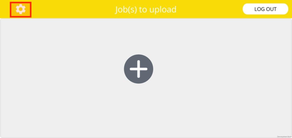
If the cogwheel does not appear, this means that your KickTheMap account is not activated for RTK mode. Please contact the vendor to get this activation.
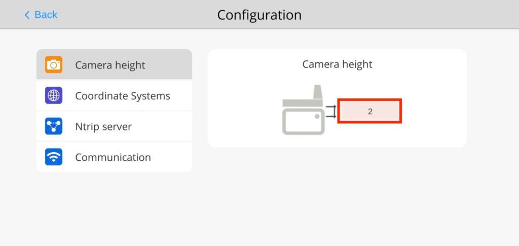
Camera height in the GNSS Antenna alignment
To achieve centimetric accuracy in image positioning, it is essential to provide the precise camera location. To do this, please specify the vertical distance (in centimeters) between the bottom edge of the HaX and the main camera within the app.
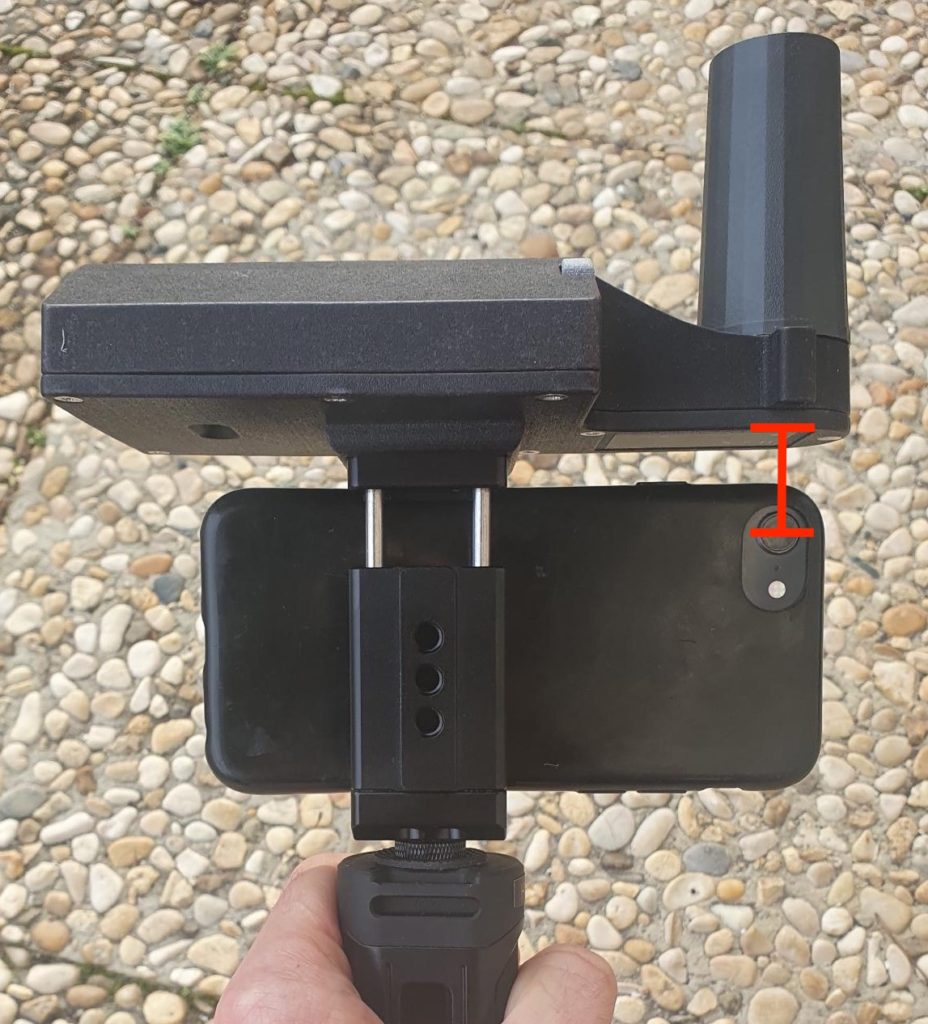
In order to get this height, you should use the ruler of the HaX to:
- align the main camera used by the KickTheMap app (every use of the HaX requires this alignment)
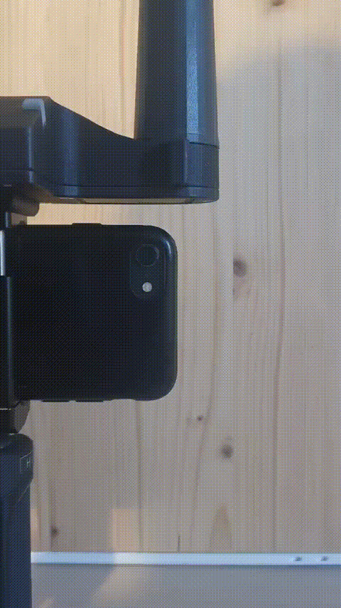
If you have more than one camera on your mobile device, an easy solution is provided in the following article to find out which camera is used by the KickTheMap application.
- Read the vertical distance on the ruler (in centimetres with decimals) between the bottom edge of the HaX and the centre of the camera as accurately as possible and enter this value into the KickTheMap app.
Millimetre accuracy is required on the camera height
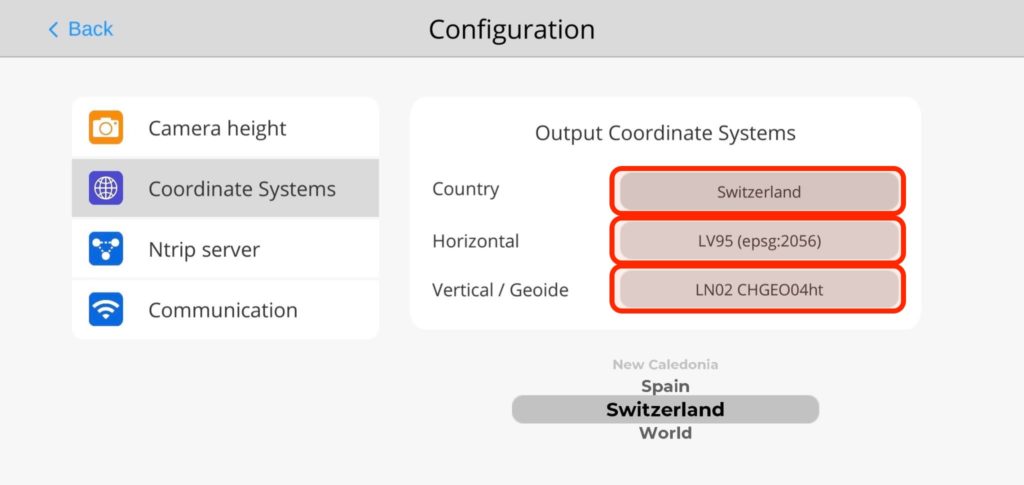
Output coordinate system for your 3D models
Select your country as well as the desired planimetric and altimetric coordinate systems for 3D models.
NTRIP Server
To achieve centimetric accuracy in image positioning, an access to a RTK correction service is required (through NTRIP).
If you do not own a licence, please contact your vendor for more information.
Enter your personal access details to the NTRIP server:
- Address, Port, Username and Password
- Select the right mounting point
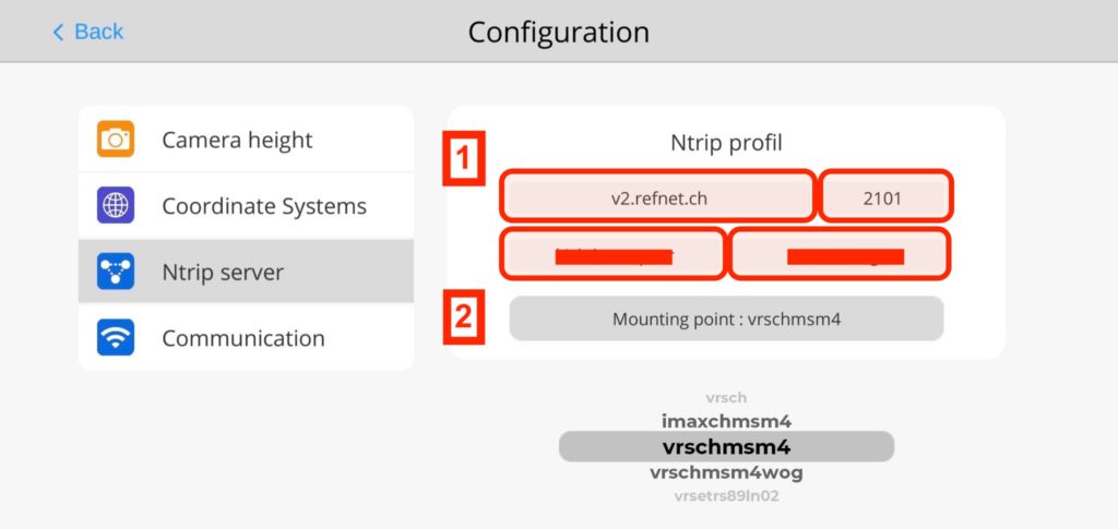
If no mounting points are loaded when pressing “Mounting Point”, it means that either your access is not granted to the server or you have a typo. In such case, you should also check your internet connection.
Make sure that the RTK corrections service selected is consistent with the output coordinate systems previously selected.
Well done! Your mobile device is now configured with the HaX RTK, you can now create your first job with your HaX RTK.
Please repeat the previous steps each time you want to set up a new mobile device with the HaX RTK.